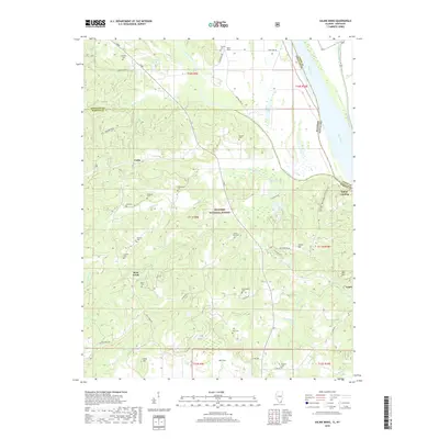
2018 Map of Saline Mines
USGS Topo · Published 2018About this map
The Saline River flows toward its confluence with the Ohio River at the border of Illinois and Kentucky, anchoring a landscape where river transport once drove the local economy. In this corner of the Shawnee National Forest, the terrain is marked by distinct geological features such as Big Sink and the elevation of Lead Hill. The map preserves the locations of numerous family and community burial grounds, including Earnshaw Cem, Stanley Cem, and Shewmaker Cem, which serve as vital markers for genealogical research in this riverine region. Settlement patterns appear concentrated near the water and along historical routes like the Beaver Trail, connecting the riverside at Saline Landing to inland points like Saline Mines. The presence of these specific mine and landing labels highlights the industrial heritage of the area, where natural resources were moved via the river network.
Find a feature on this map
58 named features on this map. Tap any name to fly to it.
Don’t see what you’re looking for? This feature index may not catch every label — zoom into the map to look around manually.
Map Details
Editions of this 2018 Saline Mines Map
This is the sole edition of this map. No revisions or reprints were ever made.
Other maps of this area

1916 · Shawneetown
USGS Topo · 1:62,500

1916 · Fords Ferry
USGS Topo · 1:62,500

1916 · Golconda
USGS Topo · 1:62,500

1916 · Equality
USGS Topo · 1:62,500

1920 · Goloonda
USGS Topo · 1:48,000

1921 · Fords Ferry
USGS Topo · 1:48,000

1921 · Golconda
USGS Topo · 1:62,500

1925 · Cave In Rock
USGS Topo · 1:62,500

1949 · Paducah
USGS Topo · 1:250,000

1950 · Paducah
USGS Topo · 1:250,000