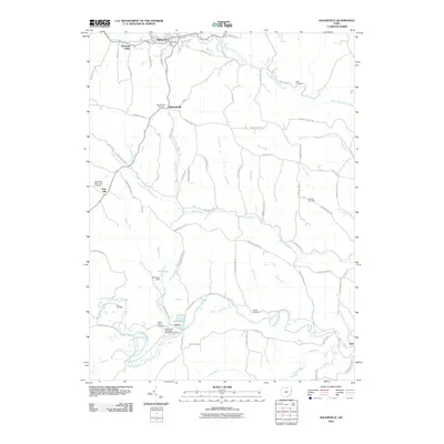
2010 Map of Salineville
USGS Topo · Published 2010About this map
Salineville stands at the northern edge of this Ohio landscape, where the Salineville Post Office serves the community near the headwaters of several drainages. The terrain is defined by the winding paths of North Fork Yellow Creek and Brush Creek, carving through the hills that characterize this part of Columbiana County. This survey reveals a dense network of local history, marked by numerous burial grounds such as the Mooretown Methodist Episcopal Cemetery and the Greenbrier-West Union Cemetery. Smaller settlements and crossroads like Monroeville, Pravo, and Diamond Valley are connected by a web of township and county roads. Water management is evident at Rod Lake, held by the Rod Lake Dam, while the southern reaches follow the course of Yellow Creek near the junction of Long Run. The distribution of cemeteries, from the Ogle Cemetery in the northeast to the Dorn Cemetery in the southwest, suggests a long-standing pattern of rural habitation and family heritage.
Find a feature on this map
68 named features on this map. Tap any name to fly to it.
Don’t see what you’re looking for? This feature index may not catch every label — zoom into the map to look around manually.
Map Details
Editions of this 2010 Salineville Map
This is the sole edition of this map. No revisions or reprints were ever made.
Other maps of this area

1901 · Cadiz
USGS Topo · 1:62,500

1903 · Cadiz
USGS Topo · 1:62,500

1904 · Wellsville
USGS Topo · 1:62,500

1904 · Steubenville
USGS Topo · 1:62,500

1905 · Salineville
USGS Topo · 1:62,500

1935 · Steubenville
USGS Topo · 1:62,500

1937 · Wellsville
USGS Topo · 1:62,500

1942 · Steubenville
USGS Topo · 1:62,500

1944 · Wellsville
USGS Topo · 1:62,500

1951 · Canton
USGS Topo · 1:250,000