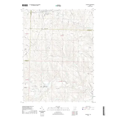
2019 Map of Salineville
USGS Topo · Published 2019About this map
Salineville sits at the northern edge of this landscape, where the waters of Riley Run and N Fork Yellow Cr meet. The area is defined by a dense network of winding valleys and ridges, with small settlements like Monroeville and Bergholz marking the intersections of township and county roads. For those researching local lineages, the map is a detailed guide to rural burial grounds, including the Mooretown Methodist Episcopal Cem and the West Grove Cem.
Find a feature on this map
98 named features on this map. Tap any name to fly to it.
Don’t see what you’re looking for? This feature index may not catch every label — zoom into the map to look around manually.
Map Details
Editions of this 2019 Salineville Map
This is the sole edition of this map. No revisions or reprints were ever made.
Other maps of this area

1901 · Cadiz
USGS Topo · 1:62,500

1903 · Cadiz
USGS Topo · 1:62,500

1904 · Wellsville
USGS Topo · 1:62,500

1904 · Steubenville
USGS Topo · 1:62,500

1905 · Salineville
USGS Topo · 1:62,500

1935 · Steubenville
USGS Topo · 1:62,500

1937 · Wellsville
USGS Topo · 1:62,500

1942 · Steubenville
USGS Topo · 1:62,500

1944 · Wellsville
USGS Topo · 1:62,500

1951 · Canton
USGS Topo · 1:250,000