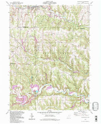
1994 Map of Salineville
USGS Topo · Published 1998About this map
Salineville serves as the primary hub of this 1994 photoinspection, situated at the junction of the North Fork Yellow Creek and Riley Run. The landscape is heavily marked by industrial activity, particularly the numerous Strip Mines and Tipples that underscore the coal mining legacy of Columbiana and Jefferson counties. In the southern half of the quadrangle, extensive resource management areas like the Yellow Creek State Forest and the Brush Creek State Wildlife Area cover significant terrain, preserving the drainage basins of Brush Creek and Yellow Creek. Local genealogy is well-documented through rural landmarks including Grants Hill Ch, Chestnut Grove Ch, and a series of family-named burial grounds such as McClelland Cem and Ogle Cem. The settlement pattern follows the narrow valleys, with Monroeville and Pravo appearing as small communities among the winding rural routes like Mc Gavern Road.
Find a feature on this map
55 named features on this map. Tap any name to fly to it.
Don’t see what you’re looking for? This feature index may not catch every label — zoom into the map to look around manually.
Map Details
Editions of this 1994 Salineville Map
This is the sole edition of this map. No revisions or reprints were ever made.
Other maps of this area

1901 · Cadiz
USGS Topo · 1:62,500

1903 · Cadiz
USGS Topo · 1:62,500

1904 · Wellsville
USGS Topo · 1:62,500

1904 · Steubenville
USGS Topo · 1:62,500

1905 · Salineville
USGS Topo · 1:62,500

1935 · Steubenville
USGS Topo · 1:62,500

1937 · Wellsville
USGS Topo · 1:62,500

1942 · Steubenville
USGS Topo · 1:62,500

1944 · Wellsville
USGS Topo · 1:62,500

1951 · Canton
USGS Topo · 1:250,000