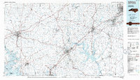
1985 Map of Salisbury
USGS Topo · Published 1986About this map
The Yadkin River and its major tributaries, including the South Yadkin River, Abbotts Creek, and Grants Creek, define the Piedmont landscape of this mid-1980s map. The industrial and transit corridor between High Point and Lexington is well-established, with the Southern Railway providing the structural backbone for textile and manufacturing hubs like Thomasville, Kannapolis, and Salisbury. Beyond the larger municipal centers, the map documents numerous smaller rural communities and historic points of interest, such as Granite Quarry, Gold Hill, and the academic grounds of Davidson College. Large water bodies like High Rock Lake and Lake Norman indicate the era's focus on hydroelectric power and recreation, while the VA Hospital and Rowan County Airport mark the infrastructure of the regional seat. For local historians, the inclusion of specific churches like St Lukes Ch and St Pauls Ch provides valuable coordinates for community genealogy.
Find a feature on this map
172 named features on this map. Tap any name to fly to it.
Don’t see what you’re looking for? This feature index may not catch every label — zoom into the map to look around manually.
Map Details
Editions of this 1985 Salisbury Map
2 editions found
Other maps of this area

1889 · Wilkesboro
USGS Topo · 1:125,000

1891 · Wilkesboro
USGS Topo · 1:125,000

1891 · Yadkinville
USGS Topo · 1:125,000

1893 · Statesville
USGS Topo · 1:125,000

1893 · Yadkinville
USGS Topo · 1:125,000

1895 · Hickory
USGS Topo · 1:125,000

1914 · Gastonia
USGS Topo · 1:48,000

1916 · Gastonia
USGS Topo · 1:62,500

1941 · Charlotte
USGS Topo · 1:125,000

1942 · Troy
USGS Topo · 1:125,000