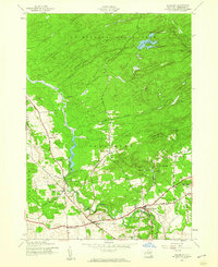
1945 Map of Salisbury
USGS Topo · Published 1960About this map
Adirondack State Park borders the northern reaches of this mid-century survey, where the hills of Herkimer County give way to a landscape defined by water management and rural crossroads. The southern portion of the map is anchored by the community of Salisbury Center and the neighboring Salisbury settlement, which sit along a network of roads connecting established family sites and local institutions. The presence of multiple cemeteries, such as St Bridget Cem and Peck Cem, alongside the Kelly Sch, provides a clear view of the area's social geography during the post-war era.
Find a feature on this map
34 named features on this map. Tap any name to fly to it.
Don’t see what you’re looking for? This feature index may not catch every label — zoom into the map to look around manually.
Map Details
Editions of this 1945 Salisbury Map
Other maps of this area

1900 · Little Falls
USGS Topo · 1:62,500

1900 · Wilmurt
USGS Topo · 1:62,500

1901 · Lassellsville
USGS Topo · 1:62,500

1902 · Wilmurt
USGS Topo · 1:62,500

1903 · Lassellsville
USGS Topo · 1:62,500

1903 · Little Falls
USGS Topo · 1:62,500

1904 · Piseco Lake
USGS Topo · 1:62,500

1906 · Piseco Lake
USGS Topo · 1:62,500

1908 · Piseco Lake
USGS Topo · 1:62,500

1939 · Little Falls
USGS Topo · 1:62,500