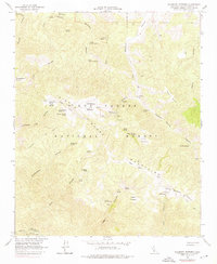
1964 Map of Salisbury Potrero
USGS Topo · Published 1976About this map
Salisbury Potrero and the high-elevation grasslands of the Sierra Madre Mountains define this mid-1960s topographic study. The landscape is characterized by a series of isolated potreros, or natural mountain meadows, including Montgomery Potrero and Santa Barbara Potrero, which provided critical water and grazing in an otherwise arid environment. These features are linked by a network of rudimentary roads and (Pack) Trails, highlighting the historical reliance on springs such as Aguadulce Spring, James Spring, and Rattlesnake Spring for survival in the backcountry.
Find a feature on this map
50 named features on this map. Tap any name to fly to it.
Don’t see what you’re looking for? This feature index may not catch every label — zoom into the map to look around manually.
Map Details
Editions of this 1964 Salisbury Potrero Map
3 editions found
Other maps of this area

1902 · Santa Ynez
USGS Topo · 1:125,000

1905 · Santa Ynez
USGS Topo · 1:125,000

1941 · San Rafael Mtn.
USGS Topo · 1:62,500

1941 · McPherson Peak
USGS Topo · 1:62,500

1942 · San Rafael Mtn.
USGS Topo · 1:62,500

1942 · East of Cuyama Ranch
USGS Topo · 1:24,000

1943 · Big Pine Mountain
USGS Topo · 1:31,680

1943 · San Rafael Mtn.
USGS Topo · 1:62,500

1943 · McPherson Peak
USGS Topo · 1:62,500

1943 · Cuyama Ranch
USGS Topo · 1:31,680