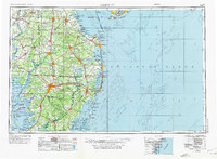
1946 Map of Salisbury
USGS Topo · Published 1975About this map
The Delmarva Peninsula during the mid-20th century is defined by its intricate network of river systems and burgeoning coastal infrastructure. The inland hub of Salisbury anchors a region where the Wicomico River and Nanticoke River facilitated trade and transport long before modern highway expansion. Along the eastern seaboard, the development of leisure and conservation is evident, from the established boardwalks of Rehoboth Beach and Ocean City to the protected expanse of the Assateague Island National Seashore.
Find a feature on this map
97 named features on this map. Tap any name to fly to it.
Don’t see what you’re looking for? This feature index may not catch every label — zoom into the map to look around manually.
Map Details
Editions of this 1946 Salisbury Map
4 editions found

Other maps of this area

1884 · Sea Isle
USGS Topo · 1:62,500

1888 · Cape May
USGS Topo · 1:62,500

1888 · Dennisville
USGS Topo · 1:62,500

1888 · Sea Isle
USGS Topo · 1:62,500

1890 · Maurice Cove
USGS Topo · 1:62,500

1891 · Maurice Cove
USGS Topo · 1:62,500

1893 · Cape May
USGS Topo · 1:62,500

1894 · Dennisville
USGS Topo · 1:62,500

1894 · Sea Isle
USGS Topo · 1:62,500

1898 · Choptank
USGS Topo · 1:125,000