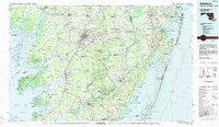
1983 Map of Salisbury
USGS Topo · Published 1984About this map
The Delmarva Peninsula's intricate intersection of land and water is documented in this 1983 study, centered on the regional hub of Salisbury. The map reveals a landscape defined by the expansive marshes of the Tangier Sound and the barrier island system of Assateague Island. This era captures the primary transportation corridors including U S Highway 13 and the Conrail lines that linked the agricultural interior to coastal settlements. Inland, the dense canopy of the Pocomoke State Forest stands in contrast to the developed corridors around Pocomoke City and Princess Anne. Along the western shore, the tidal influence is evident in the winding courses of the Nanticoke River and Manokin River. Significant conservation areas, from the Chincoteague National Wildlife Refuge to Janes Island State Park, protect the delicate wetlands that have historically supported the seafood industry in towns like Crisfield.
Find a feature on this map
100 named features on this map. Tap any name to fly to it.
Don’t see what you’re looking for? This feature index may not catch every label — zoom into the map to look around manually.
Map Details
Editions of this 1983 Salisbury Map
This is the sole edition of this map. No revisions or reprints were ever made.
Other maps of this area

1898 · Choptank
USGS Topo · 1:125,000

1898 · St. Marys
USGS Topo · 1:125,000

1901 · Snow Hill
USGS Topo · 1:62,500

1901 · Salisbury
USGS Topo · 1:62,500

1901 · Green Run
USGS Topo · 1:62,500

1901 · Ocean City
USGS Topo · 1:62,500

1902 · Pittsville
USGS Topo · 1:62,500

1903 · Crisfield
USGS Topo · 1:62,500

1903 · Nanticoke
USGS Topo · 1:62,500

1903 · Bloodsworth Island
USGS Topo · 1:62,500