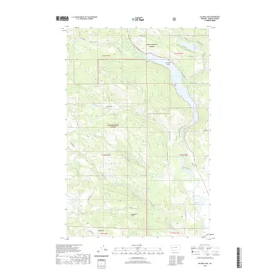
2020 Map of Salmon Lake
USGS Topo · Published 2020About this map
Salmon Lake and the winding Clearwater River anchor this portion of the Lolo National Forest in Missoula County. The landscape is defined by its complex hydrology, where Owl Creek feeds into the northern reaches while southern waters like Harpers Lake and Blanchard Lake sit in the lowlands. The presence of Sourdough Island within Salmon Lake highlights the glacial and fluvial processes that shaped this mountain valley.
Find a feature on this map
49 named features on this map. Tap any name to fly to it.
Don’t see what you’re looking for? This feature index may not catch every label — zoom into the map to look around manually.
Map Details
Editions of this 2020 Salmon Lake Map
This is the sole edition of this map. No revisions or reprints were ever made.
Other maps of this area

1902 · Ovando
USGS Topo · 1:125,000

1903 · Bonner
USGS Topo · 1:125,000

1905 · Ovando
USGS Topo · 1:125,000

1919 · Drummond
USGS Topo · 1:125,000

1921 · Drummond
USGS Topo · 1:125,000

1921 · Elbow Lake
USGS Topo · 1:125,000

1947 · Butte
USGS Topo · 1:250,000

1955 · Choteau
USGS Topo · 1:250,000

1957 · Choteau
USGS Topo · 1:250,000

1958 · Butte
USGS Topo · 1:250,000