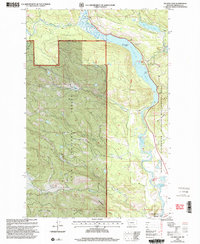
1999 Map of Salmon Lake
USGS Topo · Published 2003About this map
Salmon Lake and the Clearwater River dominate this Montana landscape, managed within the Lolo National Forest and the Blackfoot Clearwater Wildlife Management Area. The map reveals a high-elevation environment where water systems define the geography, from the sprawling Salmon Lake with its Sourdough Island to the smaller Fish Lake, Elbow Lake, and Blanchard Lake. Human presence is concentrated primarily along the eastern shore of the main lake, where St Joseph Ch and the settlement of Binko are located.
Find a feature on this map
31 named features on this map. Tap any name to fly to it.
Don’t see what you’re looking for? This feature index may not catch every label — zoom into the map to look around manually.
Map Details
Editions of this 1999 Salmon Lake Map
This is the sole edition of this map. No revisions or reprints were ever made.
Other maps of this area

1902 · Ovando
USGS Topo · 1:125,000

1903 · Bonner
USGS Topo · 1:125,000

1905 · Ovando
USGS Topo · 1:125,000

1919 · Drummond
USGS Topo · 1:125,000

1921 · Drummond
USGS Topo · 1:125,000

1921 · Elbow Lake
USGS Topo · 1:125,000

1947 · Butte
USGS Topo · 1:250,000

1955 · Choteau
USGS Topo · 1:250,000

1957 · Choteau
USGS Topo · 1:250,000

1958 · Butte
USGS Topo · 1:250,000