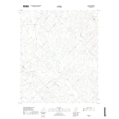
2019 Map of Salona
USGS Topo · Published 2019About this map
Salona sits at the southwestern edge of this landscape in Montague County, where the terrain is defined by a dense network of intermittent drainages and named valleys. The land is carved by the winding paths of Denton Cr, Stillhouse Cr, and Wells Br, creating a topography of ridges and hollows such as Pole Hollow. This area reflects a quiet rural character, with scattered homesteads connected by a grid of county roads like Perkins Rd and Tage Rd.
Find a feature on this map
52 named features on this map. Tap any name to fly to it.
Don’t see what you’re looking for? This feature index may not catch every label — zoom into the map to look around manually.
Map Details
Editions of this 2019 Salona Map
This is the sole edition of this map. No revisions or reprints were ever made.
Other maps of this area

1905 · Montague
USGS Topo · 1:125,000

1954 · Sherman
USGS Topo · 1:250,000

1958 · Sherman
USGS Topo · 1:250,000

1960 · Buzzard Roost Knob
USGS Topo · 1:24,000

1961 · Saint Jo
USGS Topo · 1:24,000

1961 · Salona
USGS Topo · 1:24,000

1961 · New Harp
USGS Topo · 1:24,000

1961 · Montague
USGS Topo · 1:24,000

1961 · Sunset
USGS Topo · 1:24,000
1961 · Smyrna
USGS Topo · 1:24,000