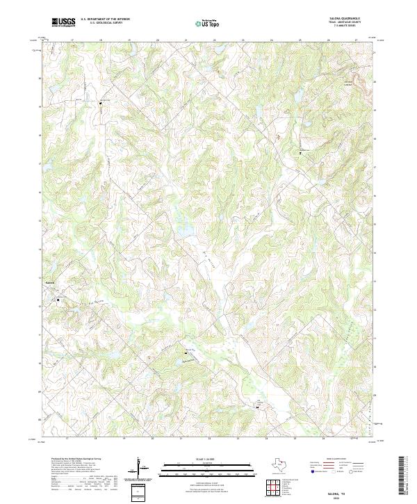
2022 Map of Salona
USGS Topo · Published 2022About this map
Salona serves as the primary hub of this Montague County landscape, where the terrain is deeply etched by a complex drainage system. Small cemeteries such as Old Liberty Cem and Denver Cem are scattered across the uplands, providing important markers for genealogical research in this rural Texas interior. The hydrology is defined by numerous seasonal and perennial flows including Denton Cr and Stillhouse Cr, which cut through the local topography to form distinct landforms like Dry Valley and Pole Hollow.
Find a feature on this map
54 named features on this map. Tap any name to fly to it.
Don’t see what you’re looking for? This feature index may not catch every label — zoom into the map to look around manually.
Map Details
Editions of this 2022 Salona Map
This is the sole edition of this map. No revisions or reprints were ever made.
Other maps of this area

1905 · Montague
USGS Topo · 1:125,000

1954 · Sherman
USGS Topo · 1:250,000

1958 · Sherman
USGS Topo · 1:250,000

1960 · Buzzard Roost Knob
USGS Topo · 1:24,000

1961 · Saint Jo
USGS Topo · 1:24,000

1961 · Salona
USGS Topo · 1:24,000

1961 · New Harp
USGS Topo · 1:24,000

1961 · Montague
USGS Topo · 1:24,000

1961 · Sunset
USGS Topo · 1:24,000
1961 · Smyrna
USGS Topo · 1:24,000