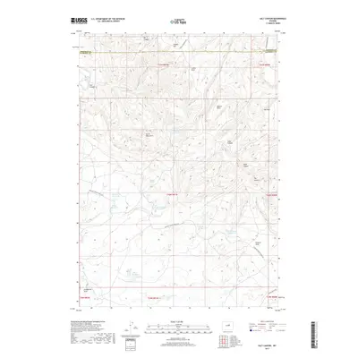
2017 Map of Salt Canyon
USGS Topo · Published 2017About this map
Tisdale Mtn rises above the border of Johnson and Natrona counties, defining a high-elevation ranching and watershed landscape. The area is marked by a complex network of canyons and draws, including the prominent Salt Canyon and the massive landform known simply as The Wall. Water management is central to the land's utility, evidenced by numerous named catchment points like Three Forks Reservoir, Willow Reservoir, and Chocolate Reservoir. These features, alongside Antelope Springs and Jacques Spring, indicate a reliance on seasonal and spring-fed resources in an arid environment. The presence of Devils Monument provides a distinct geographical landmark amidst the deep incisions of Long Canyon and Eagle Canyon, while the intersection of Antelope Springs Ranch Rd and Tisdale Mountain Rd suggests the primary routes for accessing these remote grazing lands and oil-producing pockets like Oil Canyon.
Find a feature on this map
37 named features on this map. Tap any name to fly to it.
Don’t see what you’re looking for? This feature index may not catch every label — zoom into the map to look around manually.
Map Details
Editions of this 2017 Salt Canyon Map
This is the sole edition of this map. No revisions or reprints were ever made.
Other maps of this area

1955 · Arminto
USGS Topo · 1:250,000

1958 · Arminto
USGS Topo · 1:250,000

1961 · TTT Ranch
USGS Topo · 1:24,000

1961 · Dugout Ranch
USGS Topo · 1:24,000

1961 · Wall Creek
USGS Topo · 1:24,000

1962 · Arminto
USGS Topo · 1:250,000

1968 · Big Gulch
USGS Topo · 1:24,000

1968 · Camel Hump Reservoir
USGS Topo · 1:24,000

1968 · Fiftymile Flat
USGS Topo · 1:24,000

1968 · Salt Canyon
USGS Topo · 1:24,000