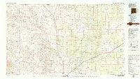
1979 Map of Salt Creek
USGS Topo · Published 1979About this map
Bitter Lake National Wildlife Refuge anchors the lower-central portion of this Chaves County landscape, where the Pecos River carves a path through the high desert. To the west, the Dr Robert Goddard Original Rocket Tower Site stands as a unique monument to early aerospace history near the banks of Salt Creek. The terrain is defined by a dense network of drainage systems including Macho Creek, Fivemile Draw, and Huggins Draw, which feed toward the river valley. Sparse ranching settlements like Elkins and Acme are connected by U.S. 285 and the tracks of the Atchison Topeka and Santa Fe Railroad. The map captures a transitional landscape of mesas and basins, notably Railroad Mountain and Palma Mesa, dotted with critical water sources such as School Section Well and Sardine Lake.
Find a feature on this map
47 named features on this map. Tap any name to fly to it.
Don’t see what you’re looking for? This feature index may not catch every label — zoom into the map to look around manually.
Map Details
Editions of this 1979 Salt Creek Map
This is the sole edition of this map. No revisions or reprints were ever made.
Other maps of this area

1936 · Arabela
USGS Topo · 1:48,000

1942 · Arabela
USGS Topo · 1:62,500

1949 · Sardine Mountain
USGS Topo · 1:24,000

1949 · Roswell North
USGS Topo · 1:24,000

1949 · L-E Ranch
USGS Topo · 1:24,000

1949 · Corn Ranch
USGS Topo · 1:24,000

1950 · Corn Ranch
USGS Topo · 1:24,000

1950 · Comanche Spring
USGS Topo · 1:24,000

1950 · Bitter Lake
USGS Topo · 1:24,000

1954 · Fort Sumner
USGS Topo · 1:250,000