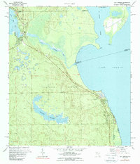
1970 Map of Salt Springs
USGS Topo · Published 1989About this map
Salt Springs sits at the head of Salt Springs Run in this 1970s-era topographic study, marking a transition from the wooded uplands of the Ocala National Forest to the expansive waters of Lake George. The map details the aquatic geography of the region, where the St Johns River flows past Drayton Island and Hog Island. Interior features include the sprawling Hopkins Prairie, a complex wetland landscape crisscrossed by Jeep Trails. Local history and infrastructure are noted via the local Cemetery, a Lookout Tower, and a Radio Tower near the main settlement. The survey carefully records the convergence of multiple county lines—Putnam, Marion, Volusia, and Lake—which meet in the middle of these waterways and marshes.
Find a feature on this map
24 named features on this map. Tap any name to fly to it.
Don’t see what you’re looking for? This feature index may not catch every label — zoom into the map to look around manually.
Map Details
Editions of this 1970 Salt Springs Map
2 editions found
Other maps of this area

1954 · Daytona Beach
USGS Topo · 1:250,000

1958 · Daytona Beach
USGS Topo · 1:250,000

1964 · Daytona Beach
USGS Topo · 1:250,000

1970 · Crescent City
USGS Topo · 1:24,000

1970 · Welaka SE
USGS Topo · 1:24,000

1970 · Welaka
USGS Topo · 1:24,000
1970 · Lake Delancy
USGS Topo · 1:24,000

1970 · Salt Springs
USGS Topo · 1:24,000

1970 · Halfmoon Lake
USGS Topo · 1:24,000
1970 · Lake Kerr
USGS Topo · 1:24,000