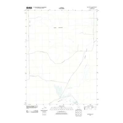
2011 Map of Salt Wells
USGS Topo · Published 2011About this map
Hansel Mountains define the central topography of this northern Utah landscape, casting a rain shadow over the arid basins below. The drainage network is dominated by the ephemeral Hansel Valley Wash, which courses through Hansel Valley toward the low-lying Salt Wells Flat. This area is characterized by its stark, open terrain and specialized hydrology, where the namesake Salt Wells provide a critical water source in a region otherwise dominated by salt flats and sagebrush. The transportation network consists of a sparse grid of rural routes, including Salt Wells Rd and the phonetic variant Hancel Mountain Rd, which provide access to the expansive Sage Valley. These corridors trace the natural contours of the basin-and-range geography, connecting remote sections of Box Elder County.
Find a feature on this map
12 named features on this map. Tap any name to fly to it.
Don’t see what you’re looking for? This feature index may not catch every label — zoom into the map to look around manually.
Map Details
Editions of this 2011 Salt Wells Map
This is the sole edition of this map. No revisions or reprints were ever made.
Other maps of this area

1954 · Brigham City
USGS Topo · 1:250,000

1958 · Brigham City
USGS Topo · 1:250,000

1962 · Brigham City
USGS Topo · 1:250,000

1968 · Lake Ridge
USGS Topo · 1:24,000

1968 · Sunset Pass
USGS Topo · 1:24,000

1968 · Monument Point
USGS Topo · 1:24,000

1968 · Salt Wells
USGS Topo · 1:24,000

1968 · Rattlesnake Pass
USGS Topo · 1:24,000

1968 · Snowville
USGS Topo · 1:24,000
1968 · Bulls Pass
USGS Topo · 1:24,000