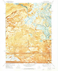
1972 Map of Saltair
USGS Topo · Published 1975About this map
Great Salt Lake dominates the northern reaches of this landscape, its fluctuating shoreline defining a world of Alkali Mud and isolated rises like Rabbit Knoll and Browns Island. In the early 1970s, the southern edge of the lake was a hub of industrial activity and recreation, featuring the Salt Evaporators and the Tailings Pond near the rail lines. The presence of numerous sportsman retreats such as the Lake Front Duck Club and Harrison Duck Club indicates the importance of these wetlands for waterfowl, specifically within the Farmington Bay Waterfowl Management Area.
Find a feature on this map
36 named features on this map. Tap any name to fly to it.
Don’t see what you’re looking for? This feature index may not catch every label — zoom into the map to look around manually.
Map Details
Editions of this 1972 Saltair Map
4 editions found
Other maps of this area

1885 · Salt Lake
USGS Topo · 1:250,000

1885 · Tooele Valley
USGS Topo · 1:250,000

1925 · Ft. Douglas
USGS Topo · 1:125,000

1928 · Ft. Douglas
USGS Topo · 1:125,000

1951 · Saltair
USGS Topo · 1:24,000

1951 · Salt Lake City South
USGS Topo · 1:24,000

1951 · Salt Lake City North
USGS Topo · 1:24,000

1952 · Saltair NE
USGS Topo · 1:24,000

1952 · Farmington
USGS Topo · 1:24,000

1952 · Magna
USGS Topo · 1:24,000