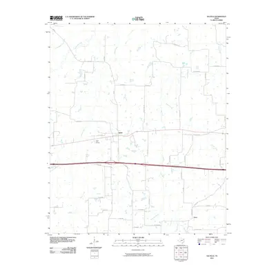
2010 Map of Saltillo
USGS Topo · Published 2010About this map
Saltillo serves as the primary hub of this East Texas landscape, where the local road network converges near the community of Union. This 2010 survey illustrates a rural terrain defined by a dense system of seasonal and perennial waterways that move through the Hopkins County countryside. Significant drainage patterns are established by Crosstimber Creek and White Oak Creek in the northwest, while the southern reaches are fed by Greenwood Creek and Huggins Creek. The map provides specific points of interest for genealogists, notably the Stouts Creek Cemetery located just west of the main settlement. The transit infrastructure is dominated by the east-west corridor of Interstate 30, supported by an Access RD and various county routes like FM 900 that link these small agricultural communities.
Find a feature on this map
48 named features on this map. Tap any name to fly to it.
Don’t see what you’re looking for? This feature index may not catch every label — zoom into the map to look around manually.
Map Details
Editions of this 2010 Saltillo Map
This is the sole edition of this map. No revisions or reprints were ever made.
Other maps of this area

1953 · Texarkana
USGS Topo · 1:250,000

1956 · Texarkana
USGS Topo · 1:250,000

1962 · Sulphur Bluff
USGS Topo · 1:24,000

1963 · Mitchell Creek
USGS Topo · 1:24,000

1964 · Mount Vernon
USGS Topo · 1:24,000

1964 · Saltillo
USGS Topo · 1:24,000

1964 · Hagansport
USGS Topo · 1:24,000

1964 · Como
USGS Topo · 1:24,000

1964 · Purley
USGS Topo · 1:24,000
1965 · New Hope
USGS Topo · 1:24,000