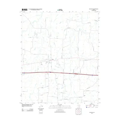
2012 Map of Saltillo
USGS Topo · Published 2012About this map
Saltillo and the smaller settlement of Union anchor this East Texas landscape, which is defined by a dense network of creek drainages. The area is heavily intersected by seasonal and perennial waterways, most notably White Oak Cr and Stouts Cr in the west, and Big Cr and Denton Cr to the east. These watercourses have historically shaped the settlement patterns and agriculture of Hopkins County.
Find a feature on this map
61 named features on this map. Tap any name to fly to it.
Don’t see what you’re looking for? This feature index may not catch every label — zoom into the map to look around manually.
Map Details
Editions of this 2012 Saltillo Map
This is the sole edition of this map. No revisions or reprints were ever made.
Other maps of this area

1953 · Texarkana
USGS Topo · 1:250,000

1956 · Texarkana
USGS Topo · 1:250,000

1962 · Sulphur Bluff
USGS Topo · 1:24,000

1963 · Mitchell Creek
USGS Topo · 1:24,000

1964 · Mount Vernon
USGS Topo · 1:24,000

1964 · Saltillo
USGS Topo · 1:24,000

1964 · Hagansport
USGS Topo · 1:24,000

1964 · Como
USGS Topo · 1:24,000

1964 · Purley
USGS Topo · 1:24,000
1965 · New Hope
USGS Topo · 1:24,000