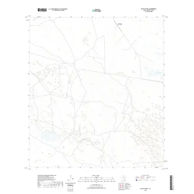
2019 Map of Saltillo Well
USGS Topo · Published 2019About this map
The coastal plains of Kenedy County appear here in a modern survey of the South Texas brush country. This landscape is defined by the ephemeral water of Cayo Soledad and a network of unimproved roads that navigate the complex patterns of wetlands and dunes typical of the Wild Horse Desert region. The infrastructure of the ranching economy is evident through the presence of the South Tajos Ranch Airport, reflecting the vast distances and specialized logistics required to manage these large-scale cattle operations. This survey documents the terrain as it existed in 2019, showcasing the sparse but vital landmarks that serve as navigation points in an area largely dominated by private landholdings and open range.
Find a feature on this map
2 named features on this map. Tap any name to fly to it.
Don’t see what you’re looking for? This feature index may not catch every label — zoom into the map to look around manually.
Map Details
Editions of this 2019 Saltillo Well Map
This is the sole edition of this map. No revisions or reprints were ever made.
Other maps of this area

1921 · Tarida Ranch
USGS Topo · 1:62,500

1922 · La Sal Vieja
USGS Topo · 1:62,500

1923 · Armstrong
USGS Topo · 1:62,500

1923 · Saltillo Ranch
USGS Topo · 1:62,500

1953 · Brownsville
USGS Topo · 1:250,000
1956 · Armstrong
USGS Topo · 1:24,000
1956 · San Pedro Ranch
USGS Topo · 1:24,000

1956 · Saltillo Well
USGS Topo · 1:24,000
1956 · Maria Estella Well
USGS Topo · 1:24,000

1956 · Rudolph
USGS Topo · 1:24,000