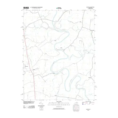
2010 Map of Salvisa
USGS Topo · Published 2010About this map
Kentucky River meanders sharply through the heart of this central Kentucky landscape, carving deep loops between the small communities of Salvisa and Mortonsville. This 2010 survey illustrates a rural region defined by its waterway and historical family ties, as evidenced by numerous scattered burial sites including Morris Cemetery, Hawkins Cemetery, and Gray Cemetery. The settlement pattern follows the high ground above the river bluffs, with hamlets like Oregon, Nonesuch, and Bondville connected by long-established roads such as Lillards Ferry Rd and Cummins Ferry Rd, which hint at former river crossings. Along a prominent bend in the river, Camp Otonka serves as a notable landmark. The topography is further etched by a network of drainage creeks, including Clay Lick Creek and Clear Creek, which feed into the river's main channel.
Find a feature on this map
46 named features on this map. Tap any name to fly to it.
Don’t see what you’re looking for? This feature index may not catch every label — zoom into the map to look around manually.
Map Details
Editions of this 2010 Salvisa Map
This is the sole edition of this map. No revisions or reprints were ever made.
Other maps of this area

1905 · Harrodsburg
USGS Topo · 1:125,000

1906 · Georgetown
USGS Topo · 1:62,500

1908 · Georgetown
USGS Topo · 1:62,500

1922 · Frankfort
USGS Topo · 1:48,000

1924 · Frankfort
USGS Topo · 1:62,500

1951 · Lawrenceburg
USGS Topo · 1:24,000

1952 · Keene
USGS Topo · 1:24,000

1952 · Harrodsburg
USGS Topo · 1:24,000

1952 · Cornishville
USGS Topo · 1:24,000

1952 · Salvisa
USGS Topo · 1:24,000