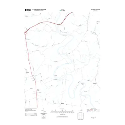
2013 Map of Salvisa
USGS Topo · Published 2013About this map
Salvisa and Mortonsville anchor this 2013 study of the central Kentucky landscape, where the winding path of the Kentucky River creates dramatic terrain features like Oregon Bend and Chapman Bend. The map documents a predominantly rural environment defined by small settlements and family-named routes, such as Harry Wise Rd and Ben Currens Rd. Local history is preserved in the names of old river crossings and crossings-turned-communities like Oregon and Ebenezer.
Find a feature on this map
80 named features on this map. Tap any name to fly to it.
Don’t see what you’re looking for? This feature index may not catch every label — zoom into the map to look around manually.
Map Details
Editions of this 2013 Salvisa Map
This is the sole edition of this map. No revisions or reprints were ever made.
Other maps of this area

1905 · Harrodsburg
USGS Topo · 1:125,000

1906 · Georgetown
USGS Topo · 1:62,500

1908 · Georgetown
USGS Topo · 1:62,500

1922 · Frankfort
USGS Topo · 1:48,000

1924 · Frankfort
USGS Topo · 1:62,500

1951 · Lawrenceburg
USGS Topo · 1:24,000

1952 · Keene
USGS Topo · 1:24,000

1952 · Harrodsburg
USGS Topo · 1:24,000

1952 · Cornishville
USGS Topo · 1:24,000

1952 · Salvisa
USGS Topo · 1:24,000