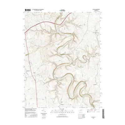
2016 Map of Salvisa
USGS Topo · Published 2016About this map
Kentucky River meanders sharply through this landscape, carving deep relief and forming the natural boundaries between Anderson, Woodford, and Mercer Counties. The river's dramatic oxbows, including Oregon Bend and Chapman Bend, define the area's geography and history, long before modern infrastructure like the Bluegrass Pkwy bridged these heights. Small, dispersed settlements such as Mortonsville and Salvisa anchor the upland plateaus, while the riverbanks show evidence of older crossings at Oregon.
Find a feature on this map
69 named features on this map. Tap any name to fly to it.
Don’t see what you’re looking for? This feature index may not catch every label — zoom into the map to look around manually.
Map Details
Editions of this 2016 Salvisa Map
This is the sole edition of this map. No revisions or reprints were ever made.
Other maps of this area

1905 · Harrodsburg
USGS Topo · 1:125,000

1906 · Georgetown
USGS Topo · 1:62,500

1908 · Georgetown
USGS Topo · 1:62,500

1922 · Frankfort
USGS Topo · 1:48,000

1924 · Frankfort
USGS Topo · 1:62,500

1951 · Lawrenceburg
USGS Topo · 1:24,000

1952 · Keene
USGS Topo · 1:24,000

1952 · Harrodsburg
USGS Topo · 1:24,000

1952 · Cornishville
USGS Topo · 1:24,000

1952 · Salvisa
USGS Topo · 1:24,000