Loading...
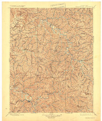
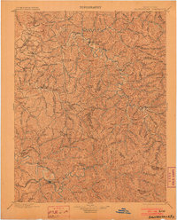
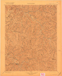
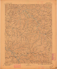
Loading map...1899 Map of Salyersville
USGS Topo · Published 1924About this map
Salyersville and West Liberty serve as the primary hubs in this late-19th-century study of the eastern Kentucky hills. The map reveals an intricate network of narrow valleys and ridges, where life followed the paths of the Licking River and the North Fork of the Kentucky River. Small agricultural and timber-linked settlements like Hazel Green, Maytown, and Ezel are shown during a period of relative isolation before modern infrastructure transformed the Cumberland Plateau.
Find a feature on this map
101 named features on this map. Tap any name to fly to it.
Don’t see what you’re looking for? This feature index may not catch every label — zoom into the map to look around manually.
Map Details
Date Portrayed1899
Date Published1924
PublisherU.S. Geological Survey
Map TypeTopographic
Scale1:125,000
Physical Dimensions17 x 20.2 inches
Editions of this 1899 Salyersville Map
4 editions found

Historical Maps of West Liberty Through Time
3 maps found

Featured Locations
Source Details
SourceU.S. Geological Survey
CopyrightPublic Domain