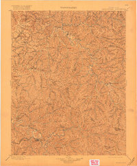
1899 Map of Salyersville
USGS Topo · Published 1918About this map
The Licking River carves a winding path through the deeply dissected Cumberland Plateau on this late 19th-century survey of eastern Kentucky. This era shows the region just as local administrative centers like West Liberty and Salyersville were firmly established as the focal points for the surrounding mountain communities. The map depicts a landscape where human settlement is strictly dictated by the drainage patterns of the North Fork and Middle Fork, with small hamlets such as Hazel Green, Maytown, and Ezel serving as remote outposts among the ridges.
Find a feature on this map
32 named features on this map. Tap any name to fly to it.
Don’t see what you’re looking for? This feature index may not catch every label — zoom into the map to look around manually.
Map Details
Editions of this 1899 Salyersville Map
4 editions found
Other maps of this area

1886 · Prestonsburg
USGS Topo · 1:125,000

1889 · Salyersville
USGS Topo · 1:125,000

1890 · Whitesburg
USGS Topo · 1:125,000

1891 · Manchester
USGS Topo · 1:125,000

1891 · Hazard
USGS Topo · 1:125,000

1891 · Salyersville
USGS Topo · 1:125,000

1892 · Whitesburg
USGS Topo · 1:125,000

1892 · Prestonsburg
USGS Topo · 1:125,000

1892 · Beattyville
USGS Topo · 1:125,000

1899 · Salyersville
USGS Topo · 1:125,000