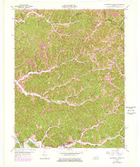
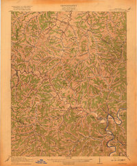
1962 Map of Salyersville North
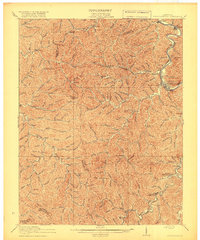
USGS Topo · Published 1978About this map
Salyersville serves as the focal point of this topographic study, situated along the banks of the Licking River where the Middle Fork and State Road Fork converge. The landscape is characterized by a dense network of steep ridges and narrow hollows, typical of the Cumberland Plateau in eastern Kentucky. This 1962 revision, updated with photorevisions in the late 1970s, captures the rural settlement patterns along the valley floors, including small communities like Lickburg, Falcon, and Wheelersburg.
Find a feature on this map
61 named features on this map. Tap any name to fly to it.
Don’t see what you’re looking for? This feature index may not catch every label — zoom into the map to look around manually.
Map Details
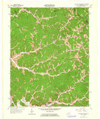
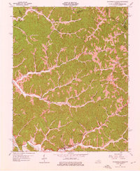
Editions of this 1962 Salyersville North Map
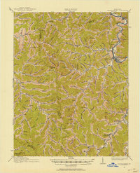
Other maps of this area

1886 · Prestonsburg
USGS Topo · 1:125,000

1889 · Salyersville
USGS Topo · 1:125,000

1891 · Salyersville
USGS Topo · 1:125,000

1892 · Prestonsburg
USGS Topo · 1:125,000

1899 · Salyersville
USGS Topo · 1:125,000

1915 · Paintsville
USGS Topo · 1:48,000
1915 · Prestonsburg
USGS Topo · 1:62,500
1917 · Paintsville
USGS Topo · 1:62,500
1918 · Prestonsburg
USGS Topo · 1:62,500

1950 · Lenox
USGS Topo · 1:24,000