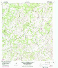
1961 Map of Sample
USGS Topo · Published 1987About this map
Sandies Creek and its numerous tributaries, including Cottonwood Creek and Shoats Creek, define the landscape of this rural South Texas region. The 1961 survey, later updated with photorevised data in 1987, reveals a sparsely populated terrain dominated by cattle ranching and early mineral extraction. Evidence of past transportation is found in the Old Railroad Grade that cuts diagonally across the northern section, while the local extractive industry is represented by scattered Quarry and Gravel Pit sites.
Find a feature on this map
19 named features on this map. Tap any name to fly to it.
Don’t see what you’re looking for? This feature index may not catch every label — zoom into the map to look around manually.
Map Details
Editions of this 1961 Sample Map
Other maps of this area

1920 · Smiley
USGS Topo · 1:125,000

1953 · Seguin
USGS Topo · 1:250,000

1958 · Seguin
USGS Topo · 1:250,000

1960 · Blackwell Lake
USGS Topo · 1:24,000

1960 · Cheapside
USGS Topo · 1:24,000

1960 · Westhoff
USGS Topo · 1:24,000

1961 · Sample
USGS Topo · 1:24,000
1961 · Pilgrim
USGS Topo · 1:24,000

1961 · New Davy
USGS Topo · 1:24,000
1962 · Smiley
USGS Topo · 1:24,000