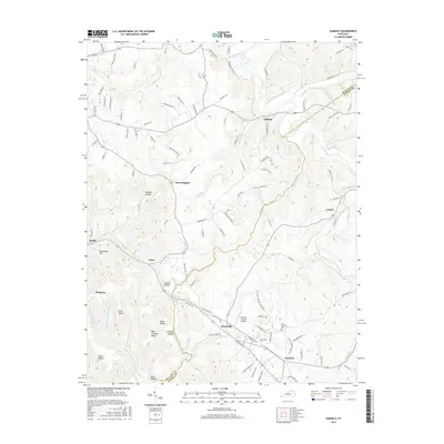
2016 Map of Samuels
USGS Topo · Published 2016About this map
Deatsville and the surrounding Nelson County countryside are defined by a network of winding creeks and ridges that shaped local settlement patterns for generations. The landscape is carved by waterways such as the Salt River, Cox Creek, and Wilson Creek, which dictate the placement of communities like Solitude and Brownington. Along the lower portion of the map, the small airfield at Samuels Springs Airport serves the local area near the community of Samuels.
Find a feature on this map
109 named features on this map. Tap any name to fly to it.
Don’t see what you’re looking for? This feature index may not catch every label — zoom into the map to look around manually.
Map Details
Editions of this 2016 Samuels Map
This is the sole edition of this map. No revisions or reprints were ever made.
Other maps of this area

1907 · Louisville
USGS Topo · 1:62,500

1929 · Taylorsville
USGS Topo · 1:62,500

1949 · Cravens
USGS Topo · 1:24,000

1949 · Shepherdsville
USGS Topo · 1:24,000

1949 · Samuels
USGS Topo · 1:24,000

1949 · Shepherdsville
USGS Topo · 1:62,500

1951 · Waterford
USGS Topo · 1:24,000
1951 · Brooks
USGS Topo · 1:24,000

1951 · Mount Washington
USGS Topo · 1:24,000
1951 · Louisville
USGS Topo · 1:62,500