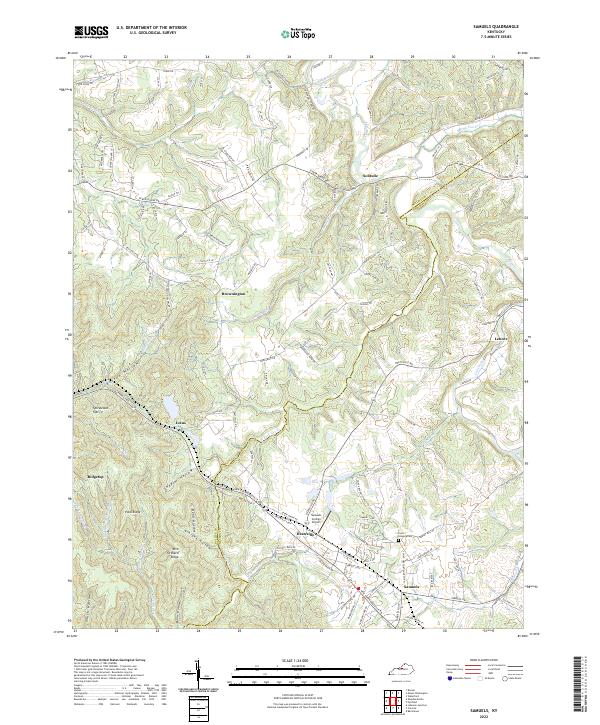
2022 Map of Samuels
USGS Topo · Published 2022About this map
Deatsville and Samuels anchor the southern portion of this landscape, where the boundary between Bullitt Co and Nelson Co carves through a network of ridges and hollows. The terrain is defined by a dense system of watercourses, including the Salt River to the north and the complex drainage of Cox Creek and its many forks. These waterways shaped the local settlement patterns, with small communities like Solitude, Brownington, and Lenore situated among the elevated terrain of Pond Ridge and Rice Orchard Ridge.
Find a feature on this map
124 named features on this map. Tap any name to fly to it.
Don’t see what you’re looking for? This feature index may not catch every label — zoom into the map to look around manually.
Map Details
Editions of this 2022 Samuels Map
This is the sole edition of this map. No revisions or reprints were ever made.
Other maps of this area

1907 · Louisville
USGS Topo · 1:62,500

1929 · Taylorsville
USGS Topo · 1:62,500

1949 · Cravens
USGS Topo · 1:24,000

1949 · Shepherdsville
USGS Topo · 1:24,000

1949 · Samuels
USGS Topo · 1:24,000

1949 · Shepherdsville
USGS Topo · 1:62,500

1951 · Waterford
USGS Topo · 1:24,000
1951 · Brooks
USGS Topo · 1:24,000

1951 · Mount Washington
USGS Topo · 1:24,000
1951 · Louisville
USGS Topo · 1:62,500