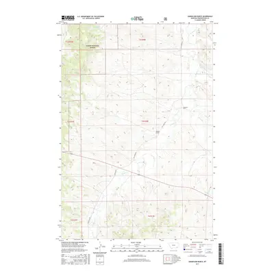
2017 Map of Samuelson Ranch
USGS Topo · Published 2017About this map
Samuelson Ranch sits as a primary landmark in this section of Powder River County, where the high plains landscape is defined by the winding course of Pumpkin Cr. This 2017 survey details a remote ranching region characterized by narrow drainage systems and isolated water sources like Manning Spring and Gain Spring. The northern portion of the quadrangle includes part of the Custer National Forest, showing the intersection of public grazing lands and private holdings. Infrastructure is sparse, anchored by the local corridors of Big Pumpkin Rd and Sonnette Rd. These routes follow the natural topography of the land, navigating through breaks like Winter Gulch and across smaller tributaries such as Titus Cr and Sixmile Cr. For those studying the rural development of Montana's eastern ranchlands, the map provides a precise look at the township and range boundaries that govern this expansive cattle country.
Find a feature on this map
18 named features on this map. Tap any name to fly to it.
Don’t see what you’re looking for? This feature index may not catch every label — zoom into the map to look around manually.
Map Details
Editions of this 2017 Samuelson Ranch Map
This is the sole edition of this map. No revisions or reprints were ever made.
Other maps of this area

1954 · Ekalaka
USGS Topo · 1:250,000

1956 · Ekalaka
USGS Topo · 1:250,000

1958 · Ekalaka
USGS Topo · 1:250,000

1965 · Ekalaka
USGS Topo · 1:250,000

1966 · Sonnette
USGS Topo · 1:24,000

1966 · Stacey
USGS Topo · 1:24,000

1966 · Home Creek Butte
USGS Topo · 1:24,000

1966 · Threemile Buttes
USGS Topo · 1:24,000

1966 · Elk Ridge
USGS Topo · 1:24,000

1966 · Samuelson Ranch
USGS Topo · 1:24,000