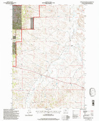
1995 Map of Samuelson Ranch
USGS Topo · Published 1998About this map
Camps Pass School and Samuelson Ranch anchor this corner of the Powder River Basin, reflecting the isolated ranching and rural educational infrastructure of southeastern Montana in the late 20th century. The landscape is defined by the winding course of Pumpkin Creek, which draws together numerous drainages including Winter Gulch, Gould Creek, and Titus Creek. The western portion of the map is dominated by the established boundaries of the Custer National Forest, where high-elevation landmarks like Manning Spring and Cain Spring provided critical water sources in an otherwise arid environment. While predominantly agricultural and wild land, the inclusion of a Gravel Pit indicates the localized extraction necessary for maintaining the remote road network connecting these homesteads.
Find a feature on this map
15 named features on this map. Tap any name to fly to it.
Don’t see what you’re looking for? This feature index may not catch every label — zoom into the map to look around manually.
Map Details
Editions of this 1995 Samuelson Ranch Map
This is the sole edition of this map. No revisions or reprints were ever made.
Other maps of this area

1954 · Ekalaka
USGS Topo · 1:250,000

1956 · Ekalaka
USGS Topo · 1:250,000

1958 · Ekalaka
USGS Topo · 1:250,000

1965 · Ekalaka
USGS Topo · 1:250,000

1966 · Sonnette
USGS Topo · 1:24,000

1966 · Stacey
USGS Topo · 1:24,000

1966 · Home Creek Butte
USGS Topo · 1:24,000

1966 · Threemile Buttes
USGS Topo · 1:24,000

1966 · Elk Ridge
USGS Topo · 1:24,000

1966 · Samuelson Ranch
USGS Topo · 1:24,000