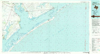
1983 Map of San Antonio Bay
USGS Topo · Published 1983About this map
Aransas National Wildlife Refuge dominates the coastal bend in the early 1980s, preserving a complex network of marshes and peninsulas between San Antonio Bay and Mesquite Bay. The landscape is defined by the shallow waters of Espiritu Santo Bay and the protective barrier of Matagorda Island, which shelters the Intracoastal Waterway from the open Gulf of Mexico. On the mainland, small fishing and ranching communities like Seadrift and Austwell sit near the estuaries where the Guadalupe River and San Antonio River meet the coast. Further south, Goose Island State Park marks the edge of the Lamar Peninsula. This era shows the region's transition into a major wildlife sanctuary and recreational hub, with an Old RR Grade cutting through the inland prairie near Tivoli, hinting at the area's earlier rail-dependent commerce.
Find a feature on this map
60 named features on this map. Tap any name to fly to it.
Don’t see what you’re looking for? This feature index may not catch every label — zoom into the map to look around manually.
Map Details
Editions of this 1983 San Antonio Bay Map
This is the sole edition of this map. No revisions or reprints were ever made.
Other maps of this area

1925 · Aransas Pass
USGS Topo · 1:62,500

1950 · Corpus Christi
USGS Topo · 1:250,000

1951 · Bay City
USGS Topo · 1:250,000

1951 · Keller Bay
USGS Topo · 1:24,000

1951 · Allyns Bight
USGS Topo · 1:24,000

1952 · Palacios SE
USGS Topo · 1:24,000

1952 · Port Lavaca East
USGS Topo · 1:24,000

1952 · Mosquito Point
USGS Topo · 1:24,000

1952 · Palacios Point
USGS Topo · 1:24,000

1952 · Pass Cavallo SW
USGS Topo · 1:24,000