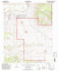
1995 Map of San Antonio Mountain
USGS Topo · Published 1997About this map
The San Antonio Mountain peak dominates this high-altitude landscape in the Carson National Forest, providing a detailed look at the grazing and water management infrastructure of Northern New Mexico during the late twentieth century. Ranching history is evident through numerous livestock watering sites such as Aguaje Tank, Salin Tank, and Felipe Tank, alongside established locations like T-Bone Ranch and Stewart Meadows.
Find a feature on this map
38 named features on this map. Tap any name to fly to it.
Don’t see what you’re looking for? This feature index may not catch every label — zoom into the map to look around manually.
Map Details
Editions of this 1995 San Antonio Mountain Map
This is the sole edition of this map. No revisions or reprints were ever made.
Other maps of this area

1918 · Tusas
USGS Topo · 1:125,000

1954 · Raton
USGS Topo · 1:250,000

1954 · Aztec
USGS Topo · 1:250,000

1958 · Raton
USGS Topo · 1:250,000

1958 · Aztec
USGS Topo · 1:250,000

1962 · Aztec
USGS Topo · 1:250,000
1963 · Los Pinos
USGS Topo · 1:24,000
1963 · Bighorn Peak
USGS Topo · 1:24,000

1963 · Pinabetoso Peaks
USGS Topo · 1:24,000

1963 · Broke Off Mountain
USGS Topo · 1:24,000