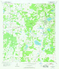
1954 Map of San Antonio
USGS Topo · Published 1969About this map
San Antonio and the nearby village of St Leo anchor this mid-century portrait of eastern Pasco County. The landscape is defined by its complex hydrology, where the high ground around the settlements gives way to the broad Thomas Prairie and a dense network of water bodies like King Lake and Clear Lake. This 1954 survey captures the region before extensive modern development, showing the established rural community structure supported by the Atlantic Coast Line railroad passing through Pasco. Local social hubs are clearly marked, including Amelia Ch and Alliance Ch, along with family-named burial grounds like Emmaus Cem and Holden Cem. The map reveals how the early citrus and ranching economy followed the natural drainage of features like Bee Tree Branch and Stanley Branch, maintaining a pastoral character even as the railroad connected these small Florida towns to the wider state.
Find a feature on this map
24 named features on this map. Tap any name to fly to it.
Don’t see what you’re looking for? This feature index may not catch every label — zoom into the map to look around manually.
Map Details
Editions of this 1954 San Antonio Map
4 editions found
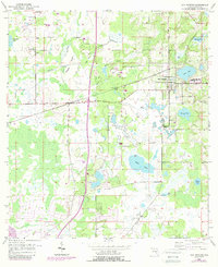

Other maps of this area

1943 · Lutz
USGS Topo · 1:24,000

1944 · Wesley Chapel
USGS Topo · 1:31,680

1944 · Lutz
USGS Topo · 1:31,680

1947 · Zephyrhills
USGS Topo · 1:24,000

1954 · Spring Lake
USGS Topo · 1:24,000

1954 · Ehren
USGS Topo · 1:24,000

1954 · San Antonio
USGS Topo · 1:24,000

1954 · Masaryktown
USGS Topo · 1:24,000

1955 · Plant City
USGS Topo · 1:250,000

1958 · Plant City
USGS Topo · 1:250,000