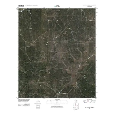
2010 Map of San Augustine Draw
USGS Topo · Published 2010About this map
San Augustines Springs and the headwaters of the San Saba River anchor the northern reaches of this rural Texas landscape. The terrain is defined by a network of drainage channels and seasonal waterways, including the prominent San Augustine Draw, which carves through the central portion of the quadrangle. Settlement is sparse and largely focused on ranching operations, such as the Womack Ranch in the southeast, which is served by the small Womack Ranch Airport. Local transportation follows established paths like Davis Rd, Benson Rd, and Hardeman Rd, tracing a path between various creek systems. The convergence of Fields Creek and Bois D'Arc Creek highlights the hydrological significance of this region within the larger watershed of West Texas.
Find a feature on this map
14 named features on this map. Tap any name to fly to it.
Don’t see what you’re looking for? This feature index may not catch every label — zoom into the map to look around manually.
Map Details
Editions of this 2010 San Augustine Draw Map
This is the sole edition of this map. No revisions or reprints were ever made.
Other maps of this area

1893 · Fort McKavett
USGS Topo · 1:125,000

1954 · Llano
USGS Topo · 1:250,000

1954 · Sonora
USGS Topo · 1:250,000

1955 · Llano
USGS Topo · 1:250,000

1956 · Llano
USGS Topo · 1:250,000

1958 · Sonora
USGS Topo · 1:250,000

1963 · McKegan Draw NE
USGS Topo · 1:24,000

1970 · Clear Creek Lake
USGS Topo · 1:24,000

1970 · San Augustine Draw
USGS Topo · 1:24,000

1970 · Julio Draw
USGS Topo · 1:24,000