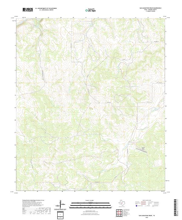
2022 Map of San Augustine Draw
USGS Topo · Published 2022About this map
The San Saba River cuts through the northern reaches of this Menard County landscape, a vital water source for the surrounding ranchlands. This terrain is defined by its drainage network, where the San Augustine Draw and several seasonal creeks like Fields Cr and Bois D'Arc Cr carve through the plateau. The presence of San Augustines Springs highlights the importance of groundwater in this semi-arid region of the Edwards Plateau. Local infrastructure is primarily geared toward ranching and private aviation, evidenced by the Womack Ranch Airport and a network of rural routes such as Ellis School Ln and Bradford Ln. The map reveals a sparsely populated area where historical land use is tied closely to the topography of draws and creeks like W Las Moras Cr and Sheen Draw.
Find a feature on this map
16 named features on this map. Tap any name to fly to it.
Don’t see what you’re looking for? This feature index may not catch every label — zoom into the map to look around manually.
Map Details
Editions of this 2022 San Augustine Draw Map
This is the sole edition of this map. No revisions or reprints were ever made.
Other maps of this area

1893 · Fort McKavett
USGS Topo · 1:125,000

1954 · Llano
USGS Topo · 1:250,000

1954 · Sonora
USGS Topo · 1:250,000

1955 · Llano
USGS Topo · 1:250,000

1956 · Llano
USGS Topo · 1:250,000

1958 · Sonora
USGS Topo · 1:250,000

1963 · McKegan Draw NE
USGS Topo · 1:24,000

1970 · Clear Creek Lake
USGS Topo · 1:24,000

1970 · San Augustine Draw
USGS Topo · 1:24,000

1970 · Julio Draw
USGS Topo · 1:24,000