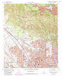
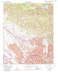
1967 Map of San Bernardino North
USGS Topo · Published 1984About this map
The San Bernardino National Forest dominates the northern half of this landscape, where steep canyons and ridges rise toward the Valley of Enchantment and Crestline. This 1967 survey, photorevised in 1980, documents the northward expansion of the Inland Empire as residential neighborhoods and institutions like California State College San Bernardino began to fill the base of the mountains. The transition from the rugged terrain of the Shandin Hills to the gridded streets of San Bernardino and Muscay illustrates the mid-century suburbanization of the region.
Find a feature on this map
120 named features on this map. Tap any name to fly to it.
Don’t see what you’re looking for? This feature index may not catch every label — zoom into the map to look around manually.
Map Details
Editions of this 1967 San Bernardino North Map
5 editions found
Other maps of this area

1896 · San Bernardino
USGS Topo · 1:62,500

1898 · San Bernardino
USGS Topo · 1:62,500

1899 · Redlands
USGS Topo · 1:62,500

1901 · Southern California Sheet No. 1
USGS Topo · 1:250,000

1901 · San Bernardino
USGS Topo · 1:62,500

1901 · Redlands
USGS Topo · 1:62,500

1902 · Deep Creek
USGS Topo · 1:62,500

1902 · Hesperia
USGS Topo · 1:62,500

1904 · Southern California Sheet No. 1
USGS Topo · 1:250,000

1936 · Devore
USGS Topo · 1:31,680