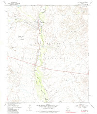
1966 Map of San Carlos
USGS Topo · Published 1985About this map
San Carlos serves as a central hub within the San Carlos Indian Reservation in the mid-1960s, situated at the confluence of the San Carlos River and Sevenmile Wash. The settlement pattern reflects the administrative and community infrastructure of the era, featuring the Indian Agency, a Hospital, and a Substation along the Southern Pacific railroad line. This corridor follows the river valley southward through Peridot, where the landscape transitions toward the striking topography of Peridot Mesa.
Find a feature on this map
38 named features on this map. Tap any name to fly to it.
Don’t see what you’re looking for? This feature index may not catch every label — zoom into the map to look around manually.
Map Details
Editions of this 1966 San Carlos Map
2 editions found
Other maps of this area

1915 · Christmas
USGS Topo · 1:62,500

1917 · Christmas
USGS Topo · 1:62,500

1954 · Mesa
USGS Topo · 1:250,000

1957 · Mesa
USGS Topo · 1:250,000

1958 · Mesa
USGS Topo · 1:250,000

1960 · Mesa
USGS Topo · 1:250,000

1962 · San Carlos Reservoir
USGS Topo · 1:62,500

1964 · Mesa
USGS Topo · 1:250,000

1965 · Sontag Mesa
USGS Topo · 1:24,000

1965 · Bucket Mtn
USGS Topo · 1:24,000