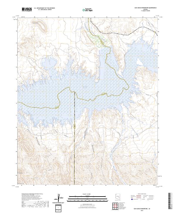
2023 Map of San Carlos Reservoir
USGS Topo · Published 2023About this map
The San Carlos Reservoir dominates this landscape, where the San Carlos River feeds into the impounded waters at the convergence of Gila, Pinal, and Graham counties. The terrain is defined by a series of deep drainages and canyons, including Willow Spring Canyon and Santa Teresa Canyon, which cut through the high ground south of the water. High points like Mt Geronimo and Rockhouse Mtn stand as prominent landmarks in the southern reach of the quadrangle. Sparse infrastructure is concentrated along the southern shoreline, where Indian Rte 3 and the winding Coolidge Dam Rd provide access to the remote backcountry. Water sources such as Quail Spring, Evans Spring, and Wire Corral Spring are critical markers for anyone tracing the historical movement of people and livestock through this arid environment.
Find a feature on this map
34 named features on this map. Tap any name to fly to it.
Don’t see what you’re looking for? This feature index may not catch every label — zoom into the map to look around manually.
Map Details
Editions of this 2023 San Carlos Reservoir Map
This is the sole edition of this map. No revisions or reprints were ever made.
Other maps of this area

1915 · Christmas
USGS Topo · 1:62,500

1917 · Christmas
USGS Topo · 1:62,500

1954 · Mesa
USGS Topo · 1:250,000

1957 · Mesa
USGS Topo · 1:250,000

1958 · Mesa
USGS Topo · 1:250,000

1960 · Mesa
USGS Topo · 1:250,000

1962 · San Carlos Reservoir
USGS Topo · 1:62,500

1964 · Mesa
USGS Topo · 1:250,000

1965 · Bucket Mtn
USGS Topo · 1:24,000
1966 · Mount Triplet
USGS Topo · 1:24,000