
1963 Map of San Diego NE
USGS Topo · Published 1964About this map
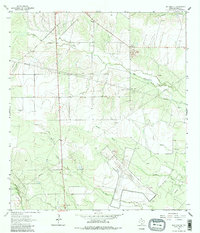
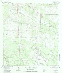
The Orange Grove Naval Auxiliary Airfield occupies a significant footprint in this 1963 landscape, where the agricultural patterns of Jim Wells Co. meet the infrastructure of the Cold War era. The terrain is defined by a dense network of intermittent waterways, including Agua Dulce Creek, Tecolote Creek, and Ruces Creek, which carve through a region heavily utilized for resource extraction. Numerous quarries and the Amargosa Oil Field indicate the industrial character of the land, supported by an extensive system of pipelines.
Find a feature on this map
18 named features on this map. Tap any name to fly to it.
Don’t see what you’re looking for? This feature index may not catch every label — zoom into the map to look around manually.
Map Details
Editions of this 1963 San Diego NE Map
3 editions found
Other maps of this area

1920 · Mikeska
USGS Topo · 1:125,000

1920 · San Diego
USGS Topo · 1:62,500

1925 · Mathis No. 3
USGS Topo · 1:48,000

1927 · Mathis
USGS Topo · 1:62,500

1950 · Corpus Christi
USGS Topo · 1:250,000

1953 · Crystal City
USGS Topo · 1:250,000

1953 · Beeville
USGS Topo · 1:250,000

1954 · Orange Grove
USGS Topo · 1:62,500

1954 · Mathis
USGS Topo · 1:62,500

1955 · Crystal City
USGS Topo · 1:250,000
Featured Places
- Salinas Colonia, TX
- Owl Ranch Number 3 Colonia, TX
- Loma Alta Ranch Colonia, TX
- Agua Dulce Ranch Number 2 Colonia, TX
- Aimee Acres Number 2 Colonia, TX