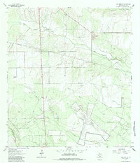
1963 Map of San Diego NE
USGS Topo · Published 1983About this map
The Orange Grove Naval Auxiliary Airfield dominates the southern landscape of this Texas coastal plain region during the early 1960s. This military installation, with its expansive runways and support structures, sits at the confluence of several seasonal watercourses including Tecolote Creek and El Caro Creek. The surrounding terrain reflects a mix of agricultural and industrial utility, characterized by numerous Quarries and an extensive network of pipelines crossing the brushy draws of Agua Dulce Creek. Local history and genealogy are centered around the Dilworth Cem and small rural nodes like Harris and McGill. The drainage patterns here, featuring names like Chiltipin Creek and Ruces Creek, illustrate the complex hydrology of Jim Wells County before widespread modern suburbanization altered the natural flow of these intermittent streams.
Find a feature on this map
16 named features on this map. Tap any name to fly to it.
Don’t see what you’re looking for? This feature index may not catch every label — zoom into the map to look around manually.
Map Details
Editions of this 1963 San Diego NE Map
3 editions found

Other maps of this area

1920 · Mikeska
USGS Topo · 1:125,000

1920 · San Diego
USGS Topo · 1:62,500

1925 · Mathis No. 3
USGS Topo · 1:48,000

1927 · Mathis
USGS Topo · 1:62,500

1950 · Corpus Christi
USGS Topo · 1:250,000

1953 · Crystal City
USGS Topo · 1:250,000

1953 · Beeville
USGS Topo · 1:250,000

1954 · Orange Grove
USGS Topo · 1:62,500

1954 · Mathis
USGS Topo · 1:62,500

1955 · Crystal City
USGS Topo · 1:250,000
Featured Places
- Salinas Colonia, TX
- Owl Ranch Number 3 Colonia, TX
- Loma Alta Ranch Colonia, TX
- Agua Dulce Ranch Number 2 Colonia, TX
- Aimee Acres Number 2 Colonia, TX