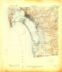
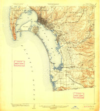
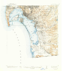
1904 Map of San Diego
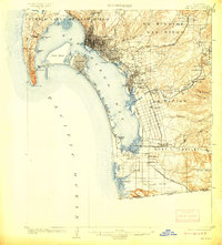
USGS Topo · Published 1915About this map
The San Diego bayfront and surrounding coastal valleys are meticulously detailed in this early twentieth-century survey, showcasing a landscape defined by its burgeoning rail infrastructure and land-grant heritage. The grid of the city expands toward the waterfront, while the Coronado Peninsula and North Island protect the harbor, connected by the Coronado R. R. traversing the narrow spit. Coastal settlements like Ocean Beach, Roseville, and La Playa sit west of the city, while the interior is carved by the Las Choyas Valley and Valley of the Sweetwater. Large tracts such as the Pueblo Lands of San Diego, La Nacion, and Ex Mission San Diego reflect the region’s transitional ownership. The southern reaches extend to the Tia Juana River at the United States Mexico border, passing through rural clusters like Otay and Nestor.
Find a feature on this map
58 named features on this map. Tap any name to fly to it.
Don’t see what you’re looking for? This feature index may not catch every label — zoom into the map to look around manually.
Map Details
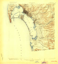
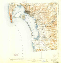
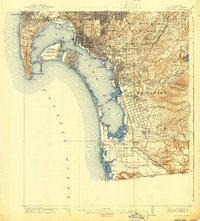
Editions of this 1904 San Diego Map
9 editions found

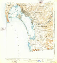
Historical Maps of Chula Vista Through Time
7 maps found