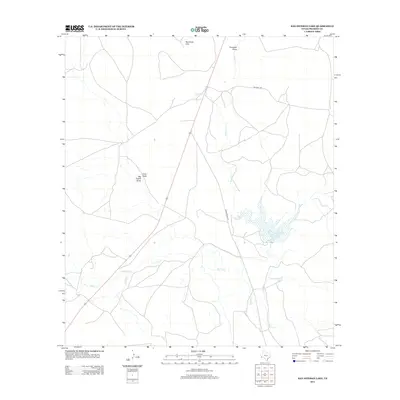
2012 Map of San Esteban Lake
USGS Topo · Published 2012About this map
San Esteban Lake serves as the focal point of this arid Presidio County landscape, where water management and ranching roads define the human footprint. The terrain is characterized by a network of ephemeral drainages including Fourmile Draw, Indian Cr, and Saucito Cr, all eventually feeding toward the Alamito Cr corridor. These watercourses are vital markers in a region where elevation changes are signaled by features like the Rancheria Hills and the distinctively named Big Trestle Draw and Long Draw.
Find a feature on this map
11 named features on this map. Tap any name to fly to it.
Don’t see what you’re looking for? This feature index may not catch every label — zoom into the map to look around manually.
Map Details
Editions of this 2012 San Esteban Lake Map
This is the sole edition of this map. No revisions or reprints were ever made.
Other maps of this area

1895 · Marfa
USGS Topo · 1:125,000

1895 · Alpine
USGS Topo · 1:125,000

1954 · Fort Stockton
USGS Topo · 1:250,000

1958 · Fort Stockton
USGS Topo · 1:250,000

1959 · Marfa
USGS Topo · 1:250,000

1965 · Marfa
USGS Topo · 1:250,000

1972 · Nopal
USGS Topo · 1:24,000

1973 · Fort Stockton
USGS Topo · 1:250,000
1983 · Tinaja
USGS Topo · 1:24,000
1983 · San Esteban Lake
USGS Topo · 1:24,000