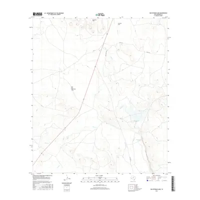
2016 Map of San Esteban Lake
USGS Topo · Published 2016About this map
San Esteban Lake serves as a central focal point in this high-desert landscape within Presidio County. The terrain is defined by a network of drainage systems, including the complex Long Draw Big Trestle Draw, Alamito Cr, and Savcito Cr, which cut through the arid plains toward the southern reaches of the map. To the north, the Rancheria Hills provide topographical variation, while Julio Cr and Fourmile Draw further illustrate the watershed's intricate design.
Find a feature on this map
12 named features on this map. Tap any name to fly to it.
Don’t see what you’re looking for? This feature index may not catch every label — zoom into the map to look around manually.
Map Details
Editions of this 2016 San Esteban Lake Map
This is the sole edition of this map. No revisions or reprints were ever made.
Other maps of this area

1895 · Marfa
USGS Topo · 1:125,000

1895 · Alpine
USGS Topo · 1:125,000

1954 · Fort Stockton
USGS Topo · 1:250,000

1958 · Fort Stockton
USGS Topo · 1:250,000

1959 · Marfa
USGS Topo · 1:250,000

1965 · Marfa
USGS Topo · 1:250,000

1972 · Nopal
USGS Topo · 1:24,000

1973 · Fort Stockton
USGS Topo · 1:250,000
1983 · Tinaja
USGS Topo · 1:24,000
1983 · San Esteban Lake
USGS Topo · 1:24,000