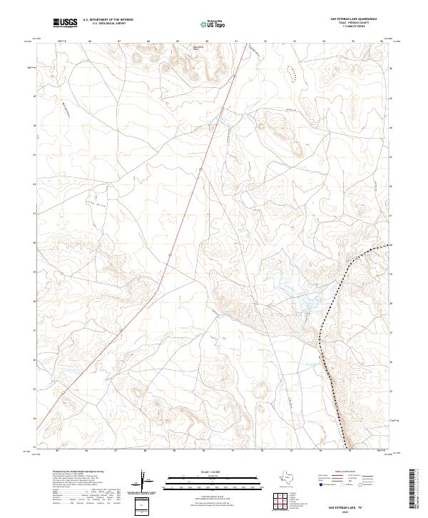
2022 Map of San Esteban Lake
USGS Topo · Published 2022About this map
San Esteban Lake serves as a primary water feature within this high-desert landscape of Presidio County, where a network of ephemeral drainages and intermittent streams defines the geography. The terrain is characterized by the Rancheria Hills and numerous named draws, including Big Trestle Draw, Long Draw, and Antelope Draw, which channel seasonal runoff toward the larger creek systems. Historical ranching infrastructure is evident through established transit routes such as Ranch Rd 169, Spriggs Ranch Rd, and Mitchell Rd.
Find a feature on this map
13 named features on this map. Tap any name to fly to it.
Don’t see what you’re looking for? This feature index may not catch every label — zoom into the map to look around manually.
Map Details
Editions of this 2022 San Esteban Lake Map
This is the sole edition of this map. No revisions or reprints were ever made.
Other maps of this area

1895 · Marfa
USGS Topo · 1:125,000

1895 · Alpine
USGS Topo · 1:125,000

1954 · Fort Stockton
USGS Topo · 1:250,000

1958 · Fort Stockton
USGS Topo · 1:250,000

1959 · Marfa
USGS Topo · 1:250,000

1965 · Marfa
USGS Topo · 1:250,000

1972 · Nopal
USGS Topo · 1:24,000

1973 · Fort Stockton
USGS Topo · 1:250,000
1983 · Tinaja
USGS Topo · 1:24,000
1983 · San Esteban Lake
USGS Topo · 1:24,000