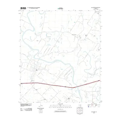
2010 Map of San Felipe
USGS Topo · Published 2010About this map
The Brazos River meanders heavily through this Austin County landscape, defining the character of San Felipe and its surrounding rural communities. The map highlights a significant concentration of historical burial sites, including Rosses Cemetery, Frydek Cemetery, and Waller Cemetery, which provide valuable location data for genealogists tracing local families. The presence of the San Felipe Oil Field and Mikeska Field illustrates the industrial footprint in a region otherwise dominated by small settlements and winding waterways.
Find a feature on this map
62 named features on this map. Tap any name to fly to it.
Don’t see what you’re looking for? This feature index may not catch every label — zoom into the map to look around manually.
Map Details
Editions of this 2010 San Felipe Map
This is the sole edition of this map. No revisions or reprints were ever made.
Other maps of this area

1950 · Houston
USGS Topo · 1:250,000

1953 · Seguin
USGS Topo · 1:250,000

1955 · Brookshire
USGS Topo · 1:62,500

1955 · Richmond
USGS Topo · 1:62,500

1956 · Sealy
USGS Topo · 1:62,500

1956 · Wallis
USGS Topo · 1:62,500

1956 · Houston
USGS Topo · 1:250,000

1958 · Seguin
USGS Topo · 1:250,000

1960 · Wallis
USGS Topo · 1:24,000

1960 · San Felipe
USGS Topo · 1:24,000