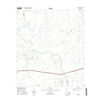
2016 Map of San Felipe
USGS Topo · Published 2016About this map
The Brazos River carves a winding path through this corner of Austin Co and Waller Co, defining a landscape where historic riverfront settlements meet modern rural communities. The town of San Felipe maintains its grid of named streets including Baron de Bastrop St and Tres Palacios St, while smaller nodes like Frydek and Clemons anchor the surrounding farm and ranch land. For family historians, the area is notably dense with burial sites, ranging from the large Saint Mary's Catholic Cem to smaller family plots such as the Edwin Waller Cem, Rosses Cem, and Kountze Cem. The terrain is characterized by low-lying wetlands and oxbow remnants like Garret Lake and Mound Lake, punctuated by the private aviation facilities of Dry Branch Ranch Airport and Mikeska Field.
Find a feature on this map
96 named features on this map. Tap any name to fly to it.
Don’t see what you’re looking for? This feature index may not catch every label — zoom into the map to look around manually.
Map Details
Editions of this 2016 San Felipe Map
This is the sole edition of this map. No revisions or reprints were ever made.
Other maps of this area

1950 · Houston
USGS Topo · 1:250,000

1953 · Seguin
USGS Topo · 1:250,000

1955 · Brookshire
USGS Topo · 1:62,500

1955 · Richmond
USGS Topo · 1:62,500

1956 · Sealy
USGS Topo · 1:62,500

1956 · Wallis
USGS Topo · 1:62,500

1956 · Houston
USGS Topo · 1:250,000

1958 · Seguin
USGS Topo · 1:250,000

1960 · Wallis
USGS Topo · 1:24,000

1960 · San Felipe
USGS Topo · 1:24,000