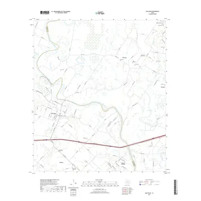
2019 Map of San Felipe
USGS Topo · Published 2019About this map
The Brazos River meanders through the heart of this landscape, separating the settlements of San Felipe and Clemons. This modern survey documents the rural character of the Austin and Waller county line, where the river's historical shifts are evidenced by a prominent Oxbow and various named waterways like Irons Cr and Bessies Bayou. For genealogists and local historians, the area is rich with family-named burial sites, including the Edwin Waller Cem, Rosses Cem, and Kholor Cem. Near the southern edge of the map, the community of Frydek sits just east of Sealy, while the recreation-focused terrain near the river is marked by several named trails such as the Copperhead Trail and Brazos-Bottom Trail. Small private aviation hubs like Dry Branch Ranch Airport and Mikeska Field provide further points of interest in this predominantly agricultural region.
Find a feature on this map
113 named features on this map. Tap any name to fly to it.
Don’t see what you’re looking for? This feature index may not catch every label — zoom into the map to look around manually.
Map Details
Editions of this 2019 San Felipe Map
This is the sole edition of this map. No revisions or reprints were ever made.
Other maps of this area

1950 · Houston
USGS Topo · 1:250,000

1953 · Seguin
USGS Topo · 1:250,000

1955 · Brookshire
USGS Topo · 1:62,500

1955 · Richmond
USGS Topo · 1:62,500

1956 · Sealy
USGS Topo · 1:62,500

1956 · Wallis
USGS Topo · 1:62,500

1956 · Houston
USGS Topo · 1:250,000

1958 · Seguin
USGS Topo · 1:250,000

1960 · Wallis
USGS Topo · 1:24,000

1960 · San Felipe
USGS Topo · 1:24,000