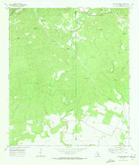
1970 Map of San Geronimo
USGS Topo · Published 1973About this map
San Geronimo Creek carves a winding path through the limestone-cut terrain of the Edwards Plateau, anchoring a landscape defined by ranching and natural springs in the early 1970s. The presence of Gallagher Ranch and Kallison Ranch illustrates the large-scale landholdings that persisted near the Bexar and Medina county lines, while landmarks like Blue Gallagher Heaven suggest the distinct character of these historic estates.
Find a feature on this map
39 named features on this map. Tap any name to fly to it.
Don’t see what you’re looking for? This feature index may not catch every label — zoom into the map to look around manually.
Map Details
Editions of this 1970 San Geronimo Map
3 editions found
Other maps of this area

1953 · Culebra Hill
USGS Topo · 1:24,000

1953 · Helotes
USGS Topo · 1:24,000

1953 · Van Raub
USGS Topo · 1:24,000

1954 · San Antonio
USGS Topo · 1:250,000

1956 · Medina Lake
USGS Topo · 1:62,500

1957 · San Antonio
USGS Topo · 1:250,000

1958 · La Coste NE
USGS Topo · 1:24,000

1964 · Riomedina
USGS Topo · 1:24,000

1964 · Medina Lake
USGS Topo · 1:24,000
1966 · Culebra Hill
USGS Topo · 1:24,000